This text was taken off a post from Gamereplays.org for the purpose of providing documentation for the version of the Supreme Scenario Editor held here. Some links have been adjusted so that images and downloads may be found relative to this HTML document. The orignal download location for the Supreme Scenario Editor v0.38 BETA was http://www.megamods.de/_data/parts/dl.php?file=76. The orignal location of this forum topic was http://www.gamereplays.org/community/index.php?showtopic=178306. If these sites are no longer active it may be possible to view them using the Web Archive.
 Dec 30 2006, 02:10 AM
Post
#
Finally! It is here, the first (inofficial) map editor for SupCom! It is still far from being feature-complete and many things can only be edited with the help of external programs, but it definately comes handy when creating new maps. Modifying the landscape itself is still limited to heightmap, texturemap and normalmap import/export. A graphical landscape editor is still on the TODO list.
Future versions will include many more features like full 3D map editing, placement of units, buildungs and wreckage on the maps, etc.
BE AWARE that this is just a Beta version for testing purposes. There might be errors, bugs, crashes and maybe even corrupted files. You are using this at you own risk! (I don't expect any massively bad things to happen, but you never know. )
)
Since the editor supports the full SCMAP format now, the loading times and the memory usage have increased alot! Especially on larger maps it does need alot of (Video- and System-)RAM. Functions like Resize, Load/Save and Import/Export may need a while to complete. Just don't panic when the app freezes for some time.
Download version 0.38 Beta HERE!
Controls
Some (yet) undocumented controls:
- Hold the H-key while drawing layer textures to see the heightmap for better coordination
- Hold the right mouse button to rotate decals
- Hold the middle mouse button to scale decals
Requirements
This tool requires the .Net Framework 2.0 and at least
the DirectX 9.0c November06 update to be installed on your
PC. If the application crashes or behaves in an unwanted
manner then download and install those updates.
.Net Framework 2.0 DOWNLOAD
DirectX Web-Updater DOWNLOAD
Changelog
Version 0.38:
- Realtime 3D Rendering of Terrain, Textures and Water
- Full in-editor Texture drawing
Version 0.35:
- Added ability to read SupCom Data (needed for textures)
- Added Prop support (add, remove, modify)
- Added Decal Texture support (add, remove, modify)
- Added Decal Normalmap support (add, remove, modify)
- Added texture layer support (solo import/export)
- Added drawing tool for future in-editor drawing
- Added first beta-test for in-editor layer drawing
- Added ability to change layer textures
- Added texture preview for decal and layer textures
- Added Enhancement Restrictions
- Added Build Restrictions (but doesn't work correctly)
- Added automatic calculation of shoreline waves
- Many other minor improvements
Version 0.282:
- Fixed a bug with maps not saved corretly under a new name
- Added option to save maps in a Beta v38 compatible format
Version 0.28:
- Added option to show a grid on the map
- Added option to calculate a buildability map (color indicates how suiteable it is as build location)
- Markers on too rough or unsuitable ground will be displayed in dark-red color now
- Modified marker icons
Version 0.27:
- Improved Open Map Dialog stability
- Added some more understandable error messages
- Forced map loading to use ASCII strings (this may fix problems with languages that use multi-byte fonts)
- Fixed the "Black Screen" bug
Version 0.26:
- Added automatic calculation of Normalmap
- Removed all (now dispensable) Normalmap controls
- Optimized performance and memory useage
- Improved zooming behaviour on large maps
- Added DXT5 warning for incompatible graphics cards
- Made preview image loading more compatible
- Added a "Quicklaunch Map" button to test the map directly
Version 0.25:
- Added "Resize Map" option
- Added "Remove Props" option
- Added "Remove Land Detail Features" option
- Added DDS to the list of Heightmap export filetypes
- Added DDS import and export for Texturemap and Normalmap
- Added automatic Calculation of Passabilitymap
- Added automatic calculation of Watermap
- Added "Display Water Overlay" option
- Added Water Level controls
- Replaced display and zooming technique completely
- Full SCMAP support
Version 0.22:
- Fixed a problem with maps disabling in-game map selection when it contains ' or " in name or description
Version 0.21:
- Added an option to select the game installation path
Version 0.2:
- First Beta Release
Known Issues
- Mouse<->Terrain intersection is still buggy. Items may not be attachted to the mouse correctly while dragging. In some situations you might not be able to select an item due to this bug. In this case flatten the terrain display by pressing Ctrl+T and select the item now.
Future Releases
- batch-drawing of props
- in-editor heightmap drawing
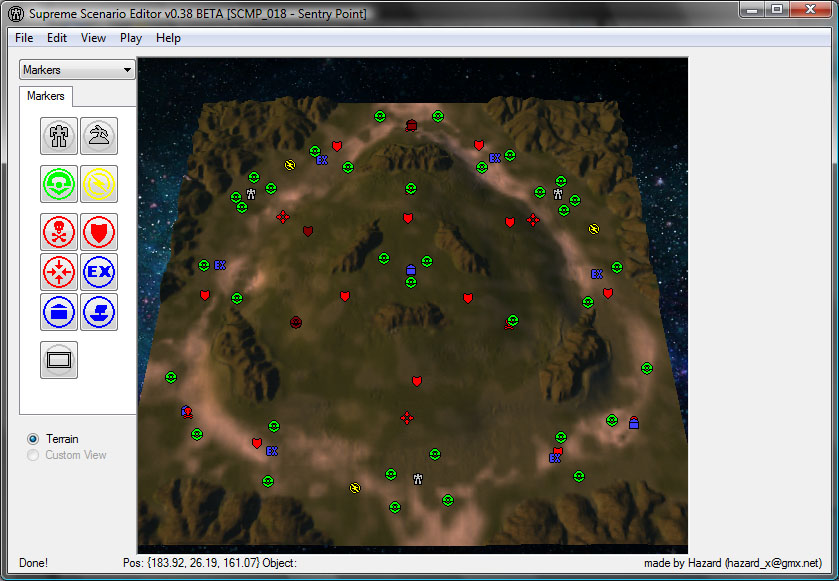
Screenshot
This post has been edited by HazardX: Feb 14 2007, 04:04 AM
Future versions will include many more features like full 3D map editing, placement of units, buildungs and wreckage on the maps, etc.
BE AWARE that this is just a Beta version for testing purposes. There might be errors, bugs, crashes and maybe even corrupted files. You are using this at you own risk! (I don't expect any massively bad things to happen, but you never know.
)
Since the editor supports the full SCMAP format now, the loading times and the memory usage have increased alot! Especially on larger maps it does need alot of (Video- and System-)RAM. Functions like Resize, Load/Save and Import/Export may need a while to complete. Just don't panic when the app freezes for some time.
Download version 0.38 Beta HERE!
Controls
Some (yet) undocumented controls:
- Hold the H-key while drawing layer textures to see the heightmap for better coordination
- Hold the right mouse button to rotate decals
- Hold the middle mouse button to scale decals
Requirements
This tool requires the .Net Framework 2.0 and at least
the DirectX 9.0c November06 update to be installed on your
PC. If the application crashes or behaves in an unwanted
manner then download and install those updates.
.Net Framework 2.0 DOWNLOAD
DirectX Web-Updater DOWNLOAD
Changelog
Version 0.38:
- Realtime 3D Rendering of Terrain, Textures and Water
- Full in-editor Texture drawing
Version 0.35:
- Added ability to read SupCom Data (needed for textures)
- Added Prop support (add, remove, modify)
- Added Decal Texture support (add, remove, modify)
- Added Decal Normalmap support (add, remove, modify)
- Added texture layer support (solo import/export)
- Added drawing tool for future in-editor drawing
- Added first beta-test for in-editor layer drawing
- Added ability to change layer textures
- Added texture preview for decal and layer textures
- Added Enhancement Restrictions
- Added Build Restrictions (but doesn't work correctly)
- Added automatic calculation of shoreline waves
- Many other minor improvements
Version 0.282:
- Fixed a bug with maps not saved corretly under a new name
- Added option to save maps in a Beta v38 compatible format
Version 0.28:
- Added option to show a grid on the map
- Added option to calculate a buildability map (color indicates how suiteable it is as build location)
- Markers on too rough or unsuitable ground will be displayed in dark-red color now
- Modified marker icons
Version 0.27:
- Improved Open Map Dialog stability
- Added some more understandable error messages
- Forced map loading to use ASCII strings (this may fix problems with languages that use multi-byte fonts)
- Fixed the "Black Screen" bug
Version 0.26:
- Added automatic calculation of Normalmap
- Removed all (now dispensable) Normalmap controls
- Optimized performance and memory useage
- Improved zooming behaviour on large maps
- Added DXT5 warning for incompatible graphics cards
- Made preview image loading more compatible
- Added a "Quicklaunch Map" button to test the map directly
Version 0.25:
- Added "Resize Map" option
- Added "Remove Props" option
- Added "Remove Land Detail Features" option
- Added DDS to the list of Heightmap export filetypes
- Added DDS import and export for Texturemap and Normalmap
- Added automatic Calculation of Passabilitymap
- Added automatic calculation of Watermap
- Added "Display Water Overlay" option
- Added Water Level controls
- Replaced display and zooming technique completely
- Full SCMAP support
Version 0.22:
- Fixed a problem with maps disabling in-game map selection when it contains ' or " in name or description
Version 0.21:
- Added an option to select the game installation path
Version 0.2:
- First Beta Release
Known Issues
- Mouse<->Terrain intersection is still buggy. Items may not be attachted to the mouse correctly while dragging. In some situations you might not be able to select an item due to this bug. In this case flatten the terrain display by pressing Ctrl+T and select the item now.
Future Releases
- batch-drawing of props
- in-editor heightmap drawing
Screenshot
This post has been edited by HazardX: Feb 14 2007, 04:04 AM